Map Illustrations – Portfolio
Expertly crafted illustrations in any style, from oversized to small, for magazines, books, museums, educational materials, park visitor centers, nature centers, public institutions, retail, advertising, and more.
Dodge Nature Center
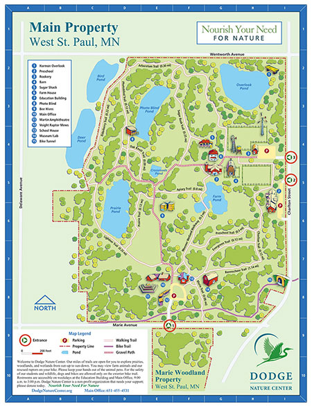
A full color illustrated map of the Dodge Nature Center, an environmental education campus in the Minneapolis–St. Paul metro area. This map was produced for kiosks, for printed distribution and as an online downloadable guide.
Cape Cod
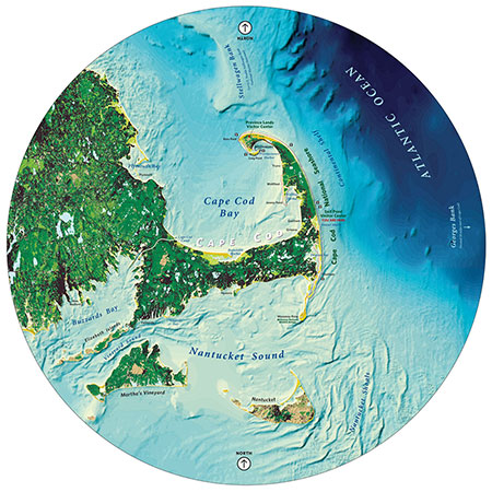
A giant walk-around interpretive map – at the Salt Pond Visitor Center of Cape Cod National Seashore. Eight feet in diameter, in fact!
Local Foods Map
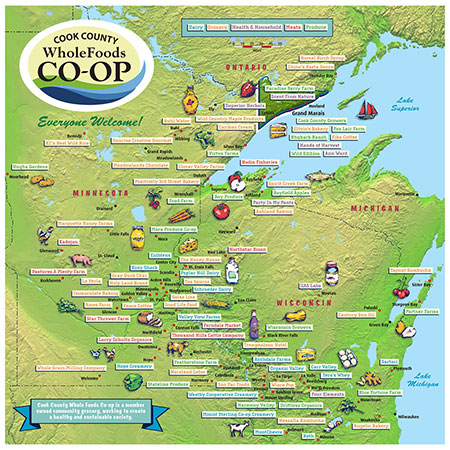
An informative wall display installed within the entryway of a whole foods cooperative – promoting the idea of local grown food sourcing.
Chipotle National Monument
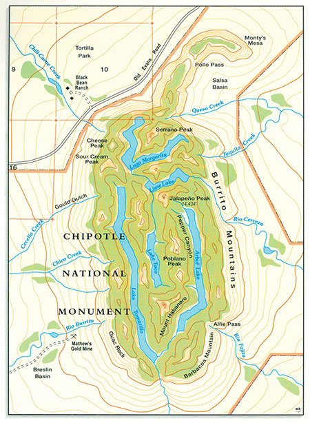
A monument to delectable burritos and tacos? In reality, a custom map illustration designed to advertise the legacy of Chipotle Mexican Grill.
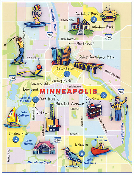
Minneapolis
What a great place to live and play – Minneapolis. As promoted via map and illustrations in You Are Here city magazine.
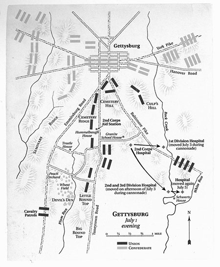
Gettysburg
A serious moment in American history deserves a serious and thoughtful map depiction. For an award-winning book on the Civil War, published by the Minnesota Historical Society.
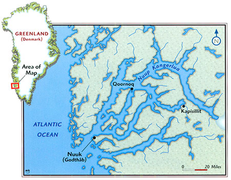
Greenland
Need to tell the story of a faraway place and make it seem right next door? A detailed map illustration is a good place to start.
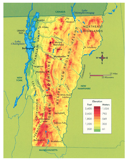
Vermont Elevations
The mountainous terrain of Vermont. Just one example of a thematic map designed for America the Beautiful state series, produced as a resource for K-12 students.
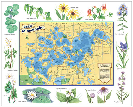
Lake Minnetonka Wildflowers
Beautiful wildflowers surround this renowned Lake Minnetonka near Minneapolis. This accurately mapped and classically illustrated keepsake poster (and collectable notecards) pays homage.
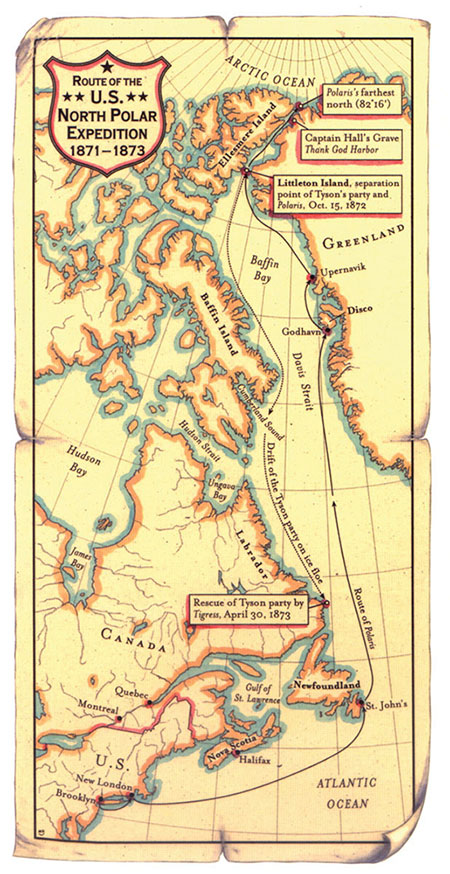
North Polar Expedition
Most of the world's greatest explorers took great joy in sharing the stories and details of their adventures. You can almost picture a veteran of the North Polar Expedition tracing a finger along this map to tell a tale about his remarkable voyage to the Arctic in the Nineteenth Century.
Map Icons
Map icons can be carefully crafted to illustrate a sense of place, an event, or a character. Integrate them with a map, then stories can begin to unfold for a reader.
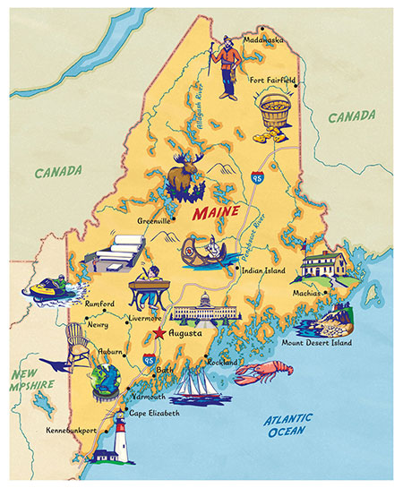
State of Maine
Welcome to the U.S.A., a state series made more enticing with the use of illustrated maps.
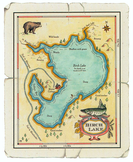
Birch Lake Resort
The perfect getaway – or hideaway? In either case, a map illustration reinforces the place.
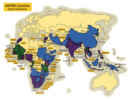
UNIFEM Countries
The United Nations Development Fund for Women. Illustrating key projects across the Eastern Hemisphere – as shown in a United Nations annual report.
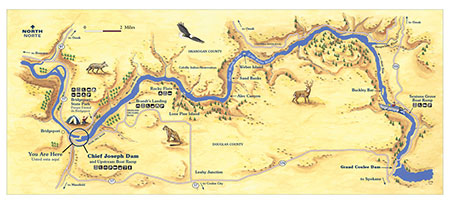
Chief Joseph Dam
A visitors map guide to Chief Joseph Dam on the Columbia River. Critters and camping await!
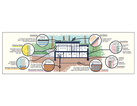
Bio Haus Diagram
More specifically “Das Waldsee BioHaus”. A map as a diagram – showing the ins and outs of a modern ‘green’ building and its merits for smart living.
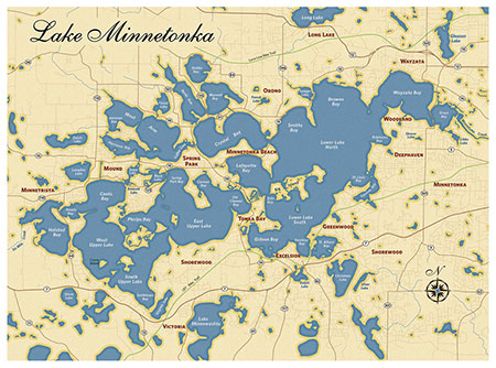
Lake Minnetonka
Appealing to the eye, beckoning for further close study, and full of accurate and interesting details – this map was used in the book Legendary Homes of Lake Minnetonka about the notable estates surrounding this magnificent lake, published by Minnesota Historical Society Press.
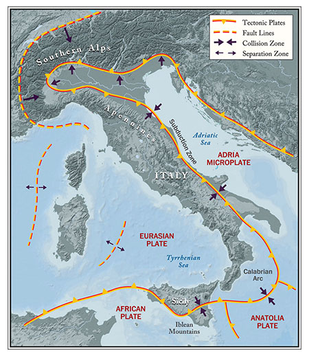
Italy Tectonics
One of a suite of maps depicting the unique geology of Italy and the historic consequences of its position in the Mediterranean – in the book Tweeting Da Vinci by Ann Pizzorusso.
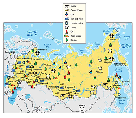
Russia Resources
A textbook example of a map that communicates about a place. A purely educational piece.
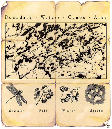
BWCA – Boundary Waters Canoe Area
One of the more unique and beautiful wilderness areas in the world. A vast area of pristine lakes and bogs interspersed with land and wildness.
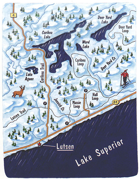
Lutsen Ski Trails
The North Shore of Lake Superior is a winter wonderland - a paradise for cross-country and downhill skiing, winter trekking, ice fishing, snowmobiling, and more. This simple yet evocative season-oriented map helped a tourism association to promote their message of winter-time fun.
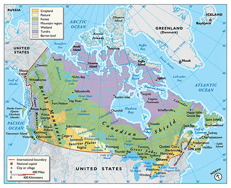
Physical Map of Canada
From tundra to pasture – a carefully crafted map depiction of Canada’s ecological regions. A textbook example of a textbook map.
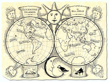
Eccentric Islands
This map is one of several created for a book about Eccentric Islands, both real and imaginary. It is a fine-lined, hand-inked illustration that was intended to help the book's readers find their way through the author's winding and well-told journey.
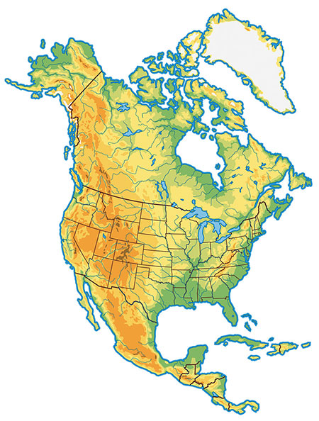
Map of North America
A common image doesn't have to be commonplace. Here is a classic depiction of the North American continent, showing mountains, river valleys, coastal features, and country (and U.S. state) borders.
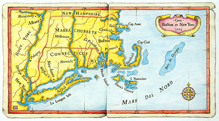
Colonial Coast
The land where the Pilgrims began their progress. This map was designed to show the New World in an Old World style. This type of map works well in color and in black and white, for magazines and books.
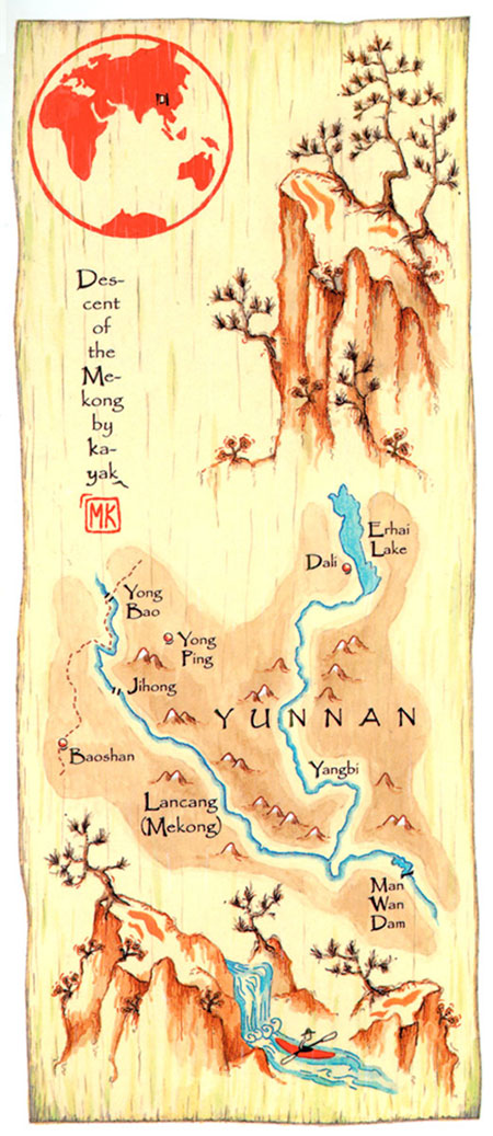
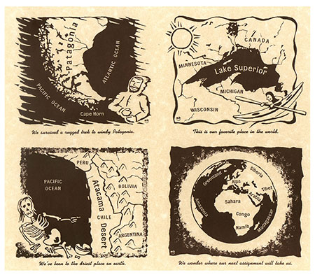
Atlas Pages
Real journeys and worldly experiences – brought to life through the use of illustrated maps. The illustration style used works great in both black-and-white or in color. It's a perfect style for adventure travel books or outdoor magazines.


